

| |
+91-9419178116 (WhatsApp) |
| |

Ladakh maps
|
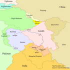
See Ladakh Boundaries and Gateways page for more information. |
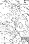
The map created by Sonam Tsetan (Leh) is schematic and quite basic in scale (approx 1:500,000). It has neither elevation contour lines nor shaded relief. However, it is a very popular overview map. As noted by Radek Kucharski in his book "Trekking in Ladakh" (2012), Sonam Tsetan's map "is accurate regarding the location of roads, trails, villages, rivers and bridges. In particular, the trail is marked on the correct side of the stream for most places, and bridges are shown where they really exist". Also, the map has the most accurate place names as it is produced by the Ladakhis.
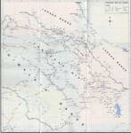
The map is available in Leh bookstores and rather cheap. The 5th edition (2007) is recommended. Here are the two scan versions of the 1st edition (2000) map, which can be found online.
 |
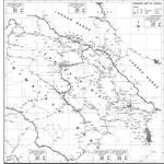 |
These maps are quite informative but should not be used as a trekking guide because they provide a schematic representation of trekking routes.
 |
 |
 |
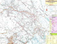
These maps are useful for planning a trip on a bike, a motorbike, or a car. The road type, distances and location of the fuel stations are indicated.
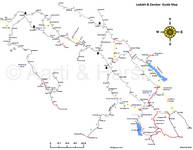 |
Road map by Harsh Vardhan (2011) |
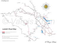 |
Road map by Vargis Khan (2017) |
|
|
|
Download |
The scanned sheets of the 2005 edition map can be found online (for example in the Library Genesis repository). Also, there is a version where the separate sheets are merged together to create a single map (North+Center+South, 3 in 1). Please note that the map is outdated and contains some mistakes (for example, the position of the Stok Kangri summit is incorrect; actually it is located at the point labeled as Kantaka peak). Here you can download the georeference file (in the OziExplorer *.map format) for the "3 in 1" map deposited in Library Genesis, which can be utilized for GPS track routing using OziExplorer, GPSMapEdit or Global Mapper programs: [ladakh_and_zanskar(north+center+south).map] (3.9 Kb). This file should be placed in the same folder as the map file named "ladakh_and_zanskar(north+center+south).jpg". |
|
Description |
This map is based primarily on the Earth's satellite images to retrieve topographic data (rivers, glaciers, roads, trails, villages, camps, etc). In most cases, the map accuracy is within 10-20 m. The map is suitable for Garmin GPS devices. |
Coverage |
Currently, the following regions are covered: central part of Ladakh (North from the Indus river), Sham, Zanskar (Northern part), Tso Moriri and Rupshu (partially), Spiti (partially). See the raster images below for more details. |
Usage |
Place the file named "gmapsupp.img" into \Garmin folder on your GPS device memory card. For better performance, the map should be used in conjunction with an elevation contour line map (20-m interval is preferred) which can be downloaded using the links above. In this case, the map files should be named as "gmapsupp1.img" and "gmapsupp2.img". The IMG map files can be opened on the PC using the free program GPSMapEdit. |
Download |
[Ladakh-Zanskar-Spiti map v1.0] (1.14 Mb) |
Raster images |
The raster images were generated by superimposition of the map on the shaded relief (based on SRTM data) in conjunction with the 100-m elevation interval contour line map. The grid lines have a spacing of 5 km. [Whole Ladakh-Zanskar-Spiti map] (79.5 Mb) [Markha valley and Stok Kangri treks] (5.2 Mb) [Sham trek] (2.8 Mb) |
Please send comments and corrections to Palden, TripsToLadakh. GPS data (treks and points) to include into the map will be much appreciated.